BUCKHANNON – Where are the best places to put a kayak in along the Buckhannon River?
That’s a question a new project dedicated to posting bulletins with kayaking information at river access points throughout the county seeks to answer for residents and visitors.
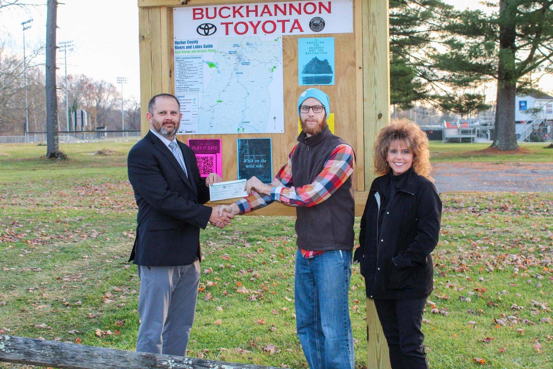
And on Wednesday, the initiative got a significant boost with a $3,000 donation from Buckhannon Toyota.
The $3,000 went toward six signs that detail places to put in a kayak and take them out; latitude and longitude coordinates to plug into a GPS; and QR codes where people can find gauges that tell them how deep the river is. The signs function as an “Upshur County Rivers and Lakes Guide.”
Signs have been installed at boat launches in the following areas: Hall road, Pringle Tree, North Buckhannon Park, Elizabeth J. “Binky” Poundstone Riverwalk, Hampton and another area along the Middle Fork River.
Member of the Upshur County Park and Recreation Board J.J. Ford said the signage is helpful for beginning, intermediate and expert kayakers alike.
“It’s for everybody because even an avid kayaker might be looking to come to the area and not know it really well,” Ford said. “That’s the other goal – trying not only to increase the community using it, but also the people outside the community coming in.”
Buckhannon Toyota General Manager Kip Cottrill said the company donated the money because it’s important to provide outside activities for community members. The business has made several donations to recreational activities for youth, including to the Stockert Youth & Community Center’s capital campaign for a new multi-purpose gymnasium facility.
“We really try to invest in the community because the community invests in us and especially kids,” Cottrill said. “This one isn’t as much geared for the kids, but it seemed like a really good cause. There’s a ton of people that use the river access. I’ve been watching and it’s pretty staggering how many there are.”
Ford said he and his wife are avid kayakers, and they are always looking for a way to make the sport more accessible.
“I do a lot of research on kayaking and then when people ask me about where to go, they seem really confused and I tell them to get the ‘Canoeing/Kayaking Guide to West Virginia’ and research it and then get on Google Earth and get a gadget here and check all this stuff on there, and they always say, ‘that seems like a lot, I’ll probably just stay home,”’ Ford said.
(Purchase the guide here or read more about West Virginia’s waterways for free here or here.)
“Providing a means for them to show up here in the right spot and know where they’re getting out, and clearly see what they’re getting themselves into, I think adds a lot of confidence and we could have a lot of people getting outside,” Ford added.
Look for more details on the project in the spring.
